The Colorado River
The 1,450-mile Colorado River is a vital lifeline for 40 million people in the Southwestern U.S. and Mexico, flowing from the Rocky Mountains to the Gulf of California. It irrigates 5 million acres of farmland and powers major hydroelectric projects like the Hoover Dam. Due to long-term drought and over-allocation, the river faces severe shortages and shrinking reservoirs.
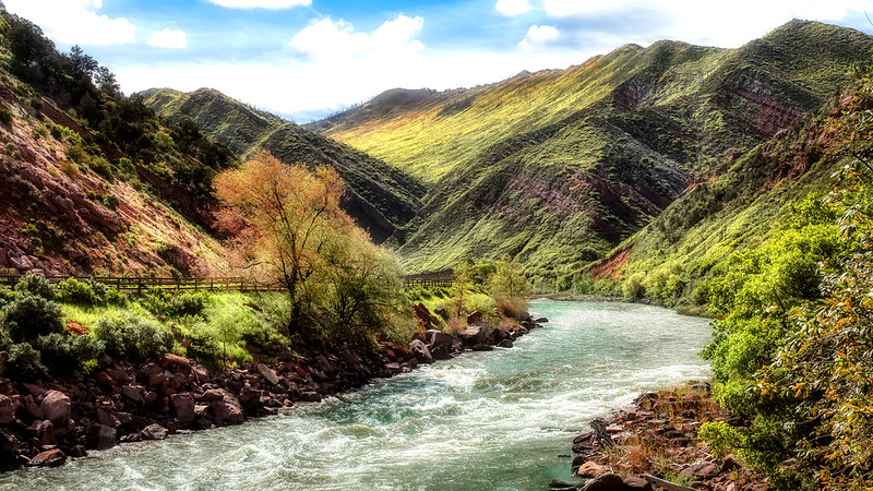
The river is a key natural resource for the States of Wyoming, Colorado, Utah, New Mexico, Nevada, Arizona, and California.It flows through 11 U.S. National Parks, including the Grand Canyon.
The river supplies major reservoirs for agricultural irrigation and municipal drinking water for cities like Los Angeles, Phoenix, and Las Vegas.It supports 30 tribal nations within the basin.
Known for its dramatic canyons, whitewater rapids, and National Parks, the Colorado River and its tributaries have a large flow and steep gradient which are used to generate hydroelectricity, meeting peaking power demands in much of the Intermountain West.
Its headwaters are in the Rocky Mountains where La Poudre Pass Lake is its source. Located in north central Colorado it flows southwest through the Colorado Plateaucountry of western Colorado, southeastern Utah and northwestern Arizona where it flows through the Grand Canyon. It turns south near Las Vegas, Nevada, forming the Arizona–Nevada border in Lake Mead and the Arizona–California border a few miles below Davis Dambetween Laughlin, Nevada and Needles, California before entering Mexico in the Colorado Desert. Most of its waters are diverted into the Imperial Valley of Southern California. In Mexico its course forms the boundary between Sonora and Baja Californiabefore entering the Gulf of California. This article describes most of the major features along the river.
Native Americans have inhabited the Colorado River basin for at least 8,000 years. Starting in the first century large agriculture-based societies were established, but a combination of drought and poor land use practices led to their collapse in the 1300s.
Their descendants include tribes such as the Puebloans, while others including the Navajo settled in the Colorado Basin after the 1000s. In the 1500s, Spanish explorers began mapping and claiming the watershed, which became part of Mexico upon winning its independence from Spain in 1821.
Even after most of the watershed became US territory in 1846, much of the river’s course remained unknown. Several expeditions charted the Colorado in the mid-19th century—one of which, led by John Wesley Powell, was the first to run the rapids of the Grand Canyon. Large-scale settlement of the lower basin began in the mid- to late-1800s, with steamboats sailing from the Gulf of California to landings along the river that linked to wagon roads to the interior. Starting in the 1860s, gold and silver strikes drew prospectors to the upper Colorado River basin.
The US federal government constructed most of the major dams and aqueducts between 1910 and 1970; the largest, Hoover Dam, was completed in 1935. Numerous water projects have also involved state and local governments. With all of their waters fully allocated, both the Colorado and the neighboring Rio Grande are now considered among the most controlled and litigated river systems in the world.
Thanks to Wikipedia
Destinations: American Rockies, Colorado and Utah, New Mexico, South West USA, California, Mexico